
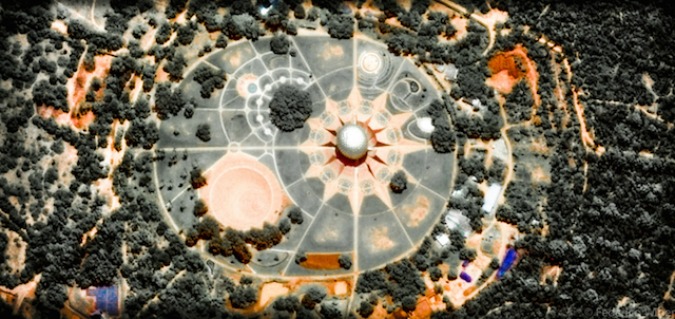

Federico Winer zooms around the world through the elevated eye of Google Earth’s satellite camera. With the click of his mouse, Winer captures Earth’s chromatic quirks and psychedelic geometric patterns in his photographic series, Ultradistancia. From his virtual vantage point, Winer adjusts the satellite image’s zoom until the world transforms into a series of abstract forms and characters. After manipulating color, brightness, and focus, the earthly appearance of his subjects falls away. What replaces it is a secret life of architecture and topography seen only from afar. (source).
[easy-share buttons=”facebook,twitter,linkedin,mail” counters=0 native=”no” image=https://live-ehc-english-ucsb-edu-v01.pantheonsite.io/wp-content/uploads/2014/11/yusuke-asai-waf-1.jpg url=https://live-ehc-english-ucsb-edu-v01.pantheonsite.io/?p=7564 facebook_text=Share twitter_text=Tweet linkedin_text=Link text=”Federico Winer’s Ultradistancia”]


